
Season 2006
Kom W
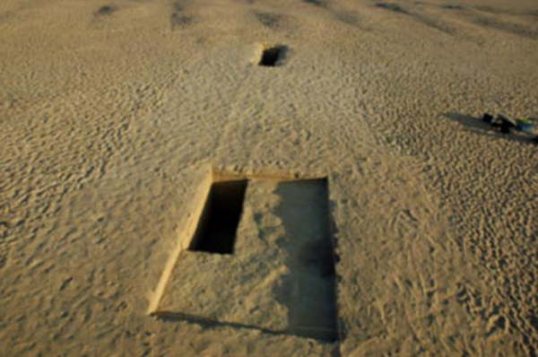
The survey of Z-Basin was continued and work started at Kom W, the Neolithic settlement site excavated in 1925 by Gertrude Caton-Thompson and Elinor Gardner. The excavation of this site is of utmost importance to provide a better understanding of the Fayum Neolithic, including dating evidence. The image below shows the trenches excavated in 1925, which are still clearly visible in the landscape today.
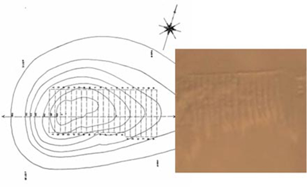
LEFT: Excavation drawing of Kom W by Caton-Thompson, 1934. RIGHT: Satellite photo of Kom W. The excavated strips A-T are clearly visible.
Two trenches were excavated at the south side of Kom W, just outside the previously excavated area, based upon the results of a magnetic survey done in 2004. In addition, a magnetic survey was done of part of the top of the kom, because closer inspection seemed to indicate that not all of the kom was excavated. This was confirmed by a small 1 x 1 m test trench which revealed that the early excavators had left 3 feet (approximately 90 cm) wide baulks between the excavated strips. This will give us the opportunity to examine in detail some of the unexcavated parts of the site in 2008. (The 2007 season will be dedicated to areas that are under immediate threat of destruction.)
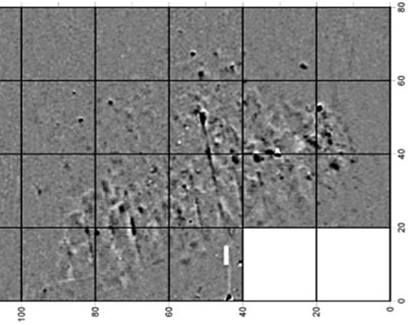
Magnetic survey of Kom W. The squares are 20x20 m. The white line at the bottom is trench KW02.
Trench KW01 in the foreground, trench KW02 in the background. The lines from the 1925 excavations are clearly visible.
Results of the excavations of Kom W were that we seem to have at least two distinctive Neolithic layers at this site. The topography, especially the presence of North-South oriented dunes, points at a period of desiccation at the end of the Holocene. The sediments in the trenches need to be examined more closely, but it seems that Kom W was established in a period that the climate was becoming drier, with lower lake stands.
Kom K
A second Neolithic settlement site, Kom K, was discovered and partly excavated by Gertrude Caton-Thompson in 1925. Since we had seen the site for the first time in 2004 no agricultural activity had taken place on the land on which Kom K is located. We decided to do a surface survey at Kom K. By making an inventory of the surface material and comparing these to the surface of Kom W, we could understand more about the nature of the two settlements.
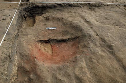
Sequence of hearths in trench KK 202
Magnetic survey of Qaret Rusas
The Roman remains at Qaret Rusas are located on a peninsula in Lake Qarun. The few remains on the surface that show that this is an antiquities site are few decorated limestone blocks and traces of mudbrick walls. It is clear that the site has been covered by the water of Lake Qarun at an unknown time for an unknown period. Not only is the surface completely leveled, but pot sherds and lime stone flakes are covered with a thick layer of calcium carbonate, which usually is indicative of a stand of 30-40 cm deep water. In order to understand the lay-out of the village, without having to excavate, the project did a magnetic survey. The map shows clear wall lines and streets in an orthogonal pattern, typical for the Greco-Roman period.
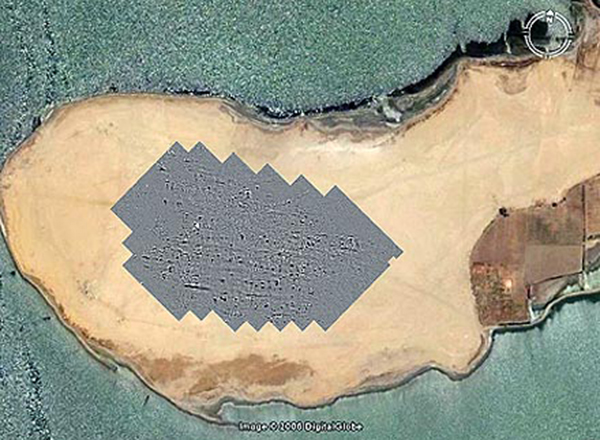
Google Earth map of the peninsula of Qaret Rusas with the magnetic map.
Site management in Karanis (Kom Aushim)
This season we continued to photograph all standing walls and covered approximately 40 percent of the site. This documentation is vital for understanding the conservation needs and the deterioration of the mud brick. At present a Virtual Reality model of Karanis is produced at UCLA, which will be used to study the site, and to illustrate the present preservation. Conservation scientist Christian Fischer studied the condition of the stones of the North and South temple at Karanis.
This season the emphasis was put on determining the exact boundaries of the site. By comparing satellite photographs with the results of a magnetic survey in the southwest and the northeast of the town, as well as the cemetery at the north side of the Cairo-Fayum road, it was established that the end of the visible remains on the surface is indeed the boundary of the town. Two trenches were started to check the magnetic results. These were excavated in the southwest area and revealed a poorly built industrial neighborhood at the edge of town.
Two trenches were placed in the area that Michigan indicated as "completely destroyed by the Sebakhin." We wanted to establish whether that destruction was indeed total, or whether some traces of the center of town still remain underneath the present sand cover. The results are that at the edges of the low lying area there are some traces to be found but in the middle no wall lines can be seen.
Now we had the opportunity to study the natural layer on which Karanis was founded. Trench KA03 showed the remains of an ancient creek or pond. At this moment it has not been established whether this fresh water source co-existed with the town, or was a much earlier phenomenon.
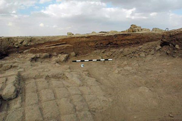
Trench KA04, with thick organic layers and top of mudbrick ramp.
Trench KA04 was started at the highest part of the site, near to where in 2004 and 2005 a 1x1 m probe was excavated. The main purpose for trench KA04 is to better understand the archaeobotanical and zooarchaeological remains at Karanis in a well excavated context. This information is of great importance to understand the life and economic activities of the inhabitants of Karanis through time.