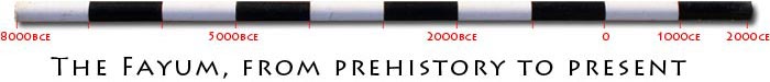

Season 2004
The Fayum Project started work on October 16 and finished work on December 30, 2004. The URU Fayum Project studies the area North and North-East of Lake Qarun from Qasr el-Sagha to Kom Aushim to understand the land use in this area over time and the development of agriculture from the Neolithic to the Greco-Roman period through survey and excavation.
Neolithic granaries
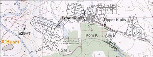
The project started survey work in the area where Gertrude Caton-Thompson and Elinor Gardner worked in 1926-1929. The results of their work were published in "The Desert Fayoum" (1934). It appeared that the settlement site of Kom K now is part of an area which was cultivated over 20 years ago. A large area of over 5200 feddan, just north of Kom K, is under development by the Public Company for Land Reclamation. It is this area that was our major concern, because it is here that the famous granaries of the "Upper K pits" and "Lower K pits" were discovered in 1926 (Caton-Thompson and Gardner 1934, 46-54).
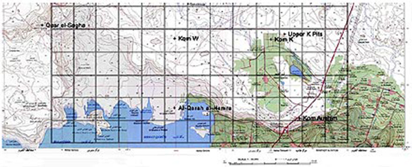
Map of the 2004 research area
Map of the land reclamation area
These granaries are an extremely important discovery, because they are the earliest evidence of agriculture in Egypt. They are absolutely unique in the world. Nowhere else is the preservation of wheat and barley of this age (5200 BCE) this good. The fact that these storage pits have survived over six millenia is one of the miracles of archaeology. Due to the relatively high elevation (32 meters above sea level) and the dry desert climate, the Kom K granaries can give us information on the domestication of grain, the development of agriculture, and the way of life of people in the Egyptian Neolithic.
There are still many questions related to the introduction of agriculture in the Nile Valley and the Kom K granaries are the key to many of the answers. Therefore, we were distressed to find that the area of the Upper and Lower K pits is under direct threat of destruction by the new land reclamation project. We could locate only one of the Lower K pits. Most granaries of this group have been destroyed by two large canals that run east-west parallel to each other and to an asphalt road.
The Upper K pits are now divided by a large canal that runs north-south and disects the ridge in which the granaries were placed. Approximately 15 pits have been destroyed by the digging of the canal. We decided to make it our priority to work in the area of the granaries and to find out what the exact situation was. We also determined that it would be of great importance to try and save this unique area for future generations and future researchers.
The Company of Public Land Reclamation was very helpful and allowed us to build a fence around an area of approximately 15 feddan around the Eastern part of the Upper K Pits. We also explored the surface in the Upper K Pits west of the canal and in this section we discovered 10 new pits, some of which are granaries, while others are pits in which the concrete was prepared that covered the pits.
Intensive survey
In addition we surveyed the entire area of the land reclamation project to map all Neolithic and Epi-paleolithic surface scatters. An intensive survey was done in X-Basin, in an area indicated as XB11. From this site all the lithic debitage and bone material has been collected as study material, because next year we will probably find ploughed fields in this area.
This year's survey extended to the area of Kom W, which is a key site for our research. A magnetic survey in this area indicated that we will still be able to recover hearths and other settlement material along the edges and to the east of the enormous trench that Caton-Thompson excavated in 1926.
al-Qarah al-Hamra
In last year's report we informed the SCA of the discovery of a new Greco-Roman site to the North-West of Qaret Rusas, which we have named el-Qarah el-Hamra after the name of the general area. In 2004 the project did a magnetic survey at this site, which showed no wall lines or other architectural features at the surface. The magnetic map shows the street plan, the outline of several large buildings and a large number of black circles which denote areas of heavy burning, probably kilns.
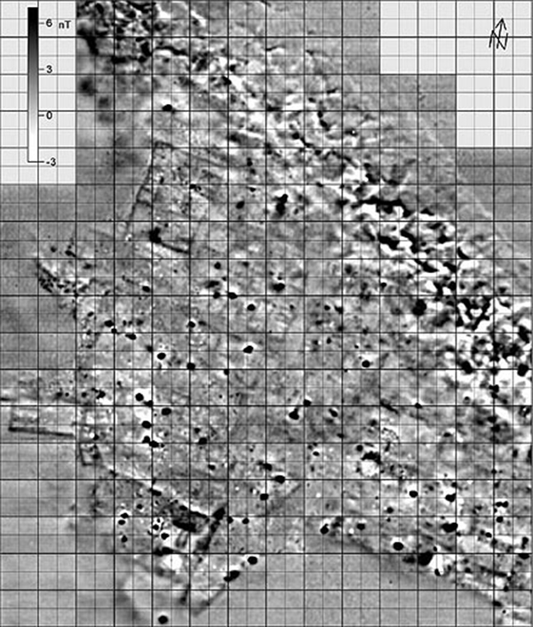
The magnetic map of el-Qarah el-Hamra, produced by the magnetic survey team led by Tomasz Herbich.
Excavations in this area were done in two trenches by the Field School team, who worked for six weeks from October 19 to December 28. Trench 1 (6 x 6 m) was in an area with substantial mud brick walls and many small installations, such as mud brick storage bins, well made floors, and a small oven.
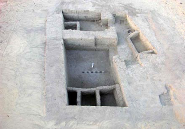
Trench 1 at el-Qarah el-Hamra
The area contained much charcoal, but most of this came from the eroded mud brick collapse, indicating that the mud brick was made from mud layers that contained much industrial waste. It is clear that the site has been covered by water from the lake after abandonment. The top layer of the mud brick has melted to form a cover over most of the trench. The rooms excavated in 2004 may be related to the activities in a large building which is located just to the north of the trench.
Trench 2 (5 x 5 m) was a kiln area, which had been heavily eroded by water activity from high lake levels which occurred some time after abandonment of the site in the late Roman period. It is an industrial area where iron working took place, with several ash concentrations and many small layers of a red colored (iron stained) deposit.
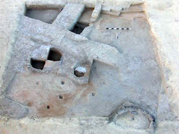
Trench 2 at el-Qarah el-Hamra
Because the preservation of organic materials in el-Qarah el-Hamra was not sufficient for our central research question, a small trench of 1 x 1 meter was excavated in a rubbish deposit in Kom Aushim. The botanical materials from this deposit were studied this season and the study will continue in the fall of 2005. Much important information on the diet and agricultural activities in the Fayum are gained from this work.